

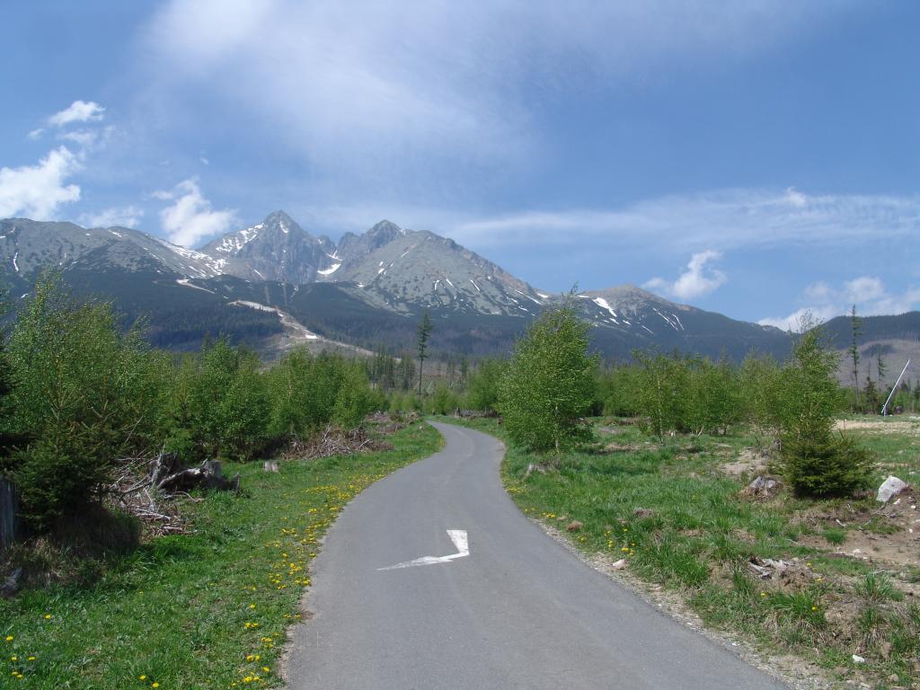
Recently, cycling has become a very popular and popular way to explore the High Tatras region. There are approximately 39 marked cycle paths with a length of more than 300 km.
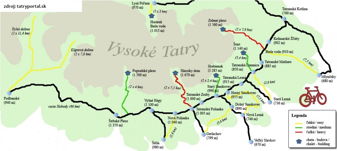
Overview of cycling routes in the High Tatras
What are suitable routes for you?
Some are designed for more experienced cyclists, others can be managed by beginners or families with children. According to the difficulty, cycling routes are divided into three groups – easy, medium and hard. Therefore, it is necessary to weigh your strength to have a perfect experience of movement and exploring the Tatra nature.
Before choosing a cycling route, it is advisable to know what the colour markings of the cycling routes mean. If you see red cycle route markings on the map, it means that these are cycle routes – long-distance routes that run through several districts and often even regions. Parallel routes to trunk routes are marked in blue – these are usually longer and more difficult routes leading off trunk routes. Medium and easy routes, known as family routes and health circuits, are marked in green. Connections between cycle routes or short diversions to various natural, historical and technical attractions are marked in yellow. Click on the image to explore all the routes.
The trails are suitable for beginners, recreational cyclists and families with children. They are characterized by a gentle climb, nice views and several places to rest. They are designed for recreational cycling.
- Kežmarské žľaby – Mlynčeky (910m – 680m; length 7.2 km)
- Nová Lesná – Horný Smokovec (750m – 950m; length 7.5 km)
- Lysá Poľana – Horáreň Biela voda (970m – 1015m; length 3 km)
- Stará Lesná – Tatranská Lomnica (736m – 850m; length 2 km)
- Štôla – Nová Polianka (980m – 1040m; length 2.8 km)
- Podbanské – crossroads under Tomanova – crossroads under Kasprový (Tichou dolina) – length 11,4 km
- Tatranské Matliare (circuit) (elevation 86m; length 4.7 km)
- Gerlachov – Motorest Raimund (Pod Lesom) – elevation 38m; length 5,6 km

- Tatranská Lomnica – Start (910m – 1140m; length 3,4 km)
- Starý Smokovec – Hrebienok (elevation 275m; length 2.4 km)
- Dolný Smokovec – Gerlachov – Veľký Slavkov (840m – 825m – 680m; length 11,5 km)
- TEŽ Popradské pleso – Chata pri Popradskom plese (length 4 km)
- Vyšné Hágy – Nižné Hágy (elevation 228m; length 2,9 km)
- Nový Smokovec – Žákovská poľana (elevation 188m; length 1,9km)
Trate sú vhodné skôr pre skúsenejších a trénovaných cyklistov, pretože terén je náročnejší s výraznejším stúpaním.
- Biela voda – Chata pri Zelenom plese (910m – 1560m; dĺžka 7,8 km)
- Tatranská Polianka – Sliezsky dom (1005m – 1670m; dĺžka 7,1 km)
- Štrbské pleso – Popradské pleso (1350m – 1500m; dĺžka 2×5,5 km)
- Starý Smokovec – Hrebienok (dĺžka 2,3 km)

Watch also
More tips can be found on the regiontatry.sk website, which offers an overview of 39 cycling routes, where you can find your cycling route in the High Tatras region using selected filters. For some cycling routes, there is even a brief description of what you can expect on the route. Each of the routes has information about its length in km, time, difficulty and elevation.
We recommend you to follow other tips on: tatryportal.sk, vt.sk.
If you don’t have your own bike with you, rental shops in Tatranská Lomnica, Štrbské Pleso and Stary Smokovec rent high-quality men’s, women’s and children’s bicycles. Prices in the rental shops range from 10 to 15 Euros per day. We would like to draw your attention to the fact that our Family Summer package includes free bicycle rental for 1 day.